| It has been suggested that this page be split into one or more multiple articles, because: (Discuss) |
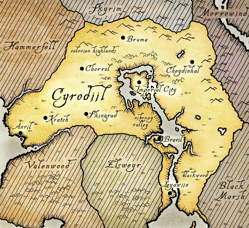
This map of Cyrodiil shows several of the country's roads.
The Imperial Road network is a network of roads connecting the major cities of Cyrodiil to each other.
History[]
In the late First Era, Empress Hestra improved the roads, and the Reman Emperors continued her policies. The last period of First Era road-building was in the reign of the last strong Akaviri Potentate, Sidri-Ashak. Prior to Tiber Septim's rule in the late Second and early Third Eras, Cyrodiil's roads varied greatly in quality, and were often impassible in bad weather and winter seasons.[1]
Cyrodiil Roads[]
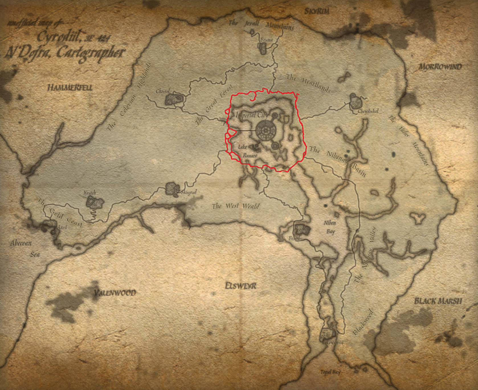
The Red Ring Road, highlighted in red.
Red Ring Road[]
The Red Ring Road runs in a circular pattern (i.e. a "Ring") around the outskirts of Lake Rumare. It also surrounds the Imperial City, because the city is build on an Island in the middle of this lake.
Black Road[]
- Runs from the Colovian Highlands and Chorrol, into Lake Rumare. The Weynon Priory also is situated next to this road.
Yellow Road[]
- Runs across the Eastern side of the Niben Bay and River regions, all the way through to Leyawiin.
Gold Road[]

The Gold Road.
- Runs from Anvil in the South East of Cyrodiil, just south of Kvatch, and through Skingrad. So named because it runs through the Gold Coast. (not to be confused with the coast of the same name in Morrowind
Orange Road[]
- Begins in Chorrol and goes through to the Silver Road, near Bruma
Blue Road[]
- Connects the Red Ring Road with Cheydinhal
Green Road[]
- Runs from the Red Ring Road in the north, starting just west of the White Rose River, and continues southwards through the Nibenay Valley, past Bravil and County Bravil, and on to Leyawiin, sticking to the Western side of the Niben River.
Silver Road[]
- Runs from Bruma through to the Red Ring Road.
Shivering Isles Roads[]
Low Road[]
- The main road in Dementia, it runs from The Fringe to New Sheoth.
Pinnacle Road[]
- A side road in Dementia, it runs from the Low Road to the end of Madgod's Boot.
Overlook Road[]
- The only road in Mania, it runs from The Fringe to New Sheoth.
See also[]
Appearances[]
References[]
- ↑ Dialogue with Mage Scholar at the Arcane University